Atnaujinkite slapukų nuostatas

Day Walks in the Brecon Beacons: 20 circular routes in South Wales Reprinted with minor amendments in June 2016. [Minkštas viršelis]

4.44/5 (18 ratings by Goodreads)
Photographs by ,
  • Formatas: Paperback / softback, 168 pages, aukštis x plotis x storis: 175x120x10 mm, weight: 210 g, Full colour photography and Ordnance Survey maps
  • Serija: Day Walks
  • Išleidimo metai: 01-Apr-2013
  • Leidėjas: Vertebrate Publishing Ltd
  • ISBN-10: 1906148627
  • ISBN-13: 9781906148621
Kitos knygos pagal šią temą:
Day Walks in the Brecon Beacons features 20 circular routes between 6.8 and 16.5 miles (11km and 16.6km) in length, suitable for hill walkers of all abilities.

Local author and walker Harri Roberts shares his favourite walks in the region, including circuits in the hills around Llangors Lake, the Taf Fechan Skyline and Pen y Fan, and the Llanbedr Horseshoe.

The routes are split into four areas - Blorenge and The Black Mountains, The Brecon Beacons, Mynydd Llangatwg and Mynydd Llangynidr, Fforest Fawr and The Black Mountain.

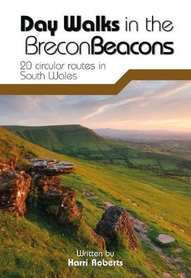
Each route features Ordnance Survey 1:25,000 maps, easy-to-follow directions, details of distance and navigation information, and refreshment stops and local information. The walks are illustrated with stunning photography by the author and outdoor photographer Adam Long.
Introduction vii
Acknowledgements viii
About the walks viii
Walk times viii
Navigation viii
GPS ix
Mobile phones ix
Footpaths and rights of way ix
Comfort ix
Safety x
Mountain Rescue x
The Countryside Code xi
How to use this book xiii
Km/mile conversion chart xiv
Welsh place names xvi
Brecon Beacons Area Map xviii
SECTION 1 BLORENGE & THE BLACK MOUNTAINS
1 A Circuit of the Blorenge - 11.5km/7.1miles
5(6)
2 Ysgyryd Fawr & Bryn Arw - 17.4km/10.8miles
11(6)
3 The Sugar Loaf & Crug Mawr - 19.8km/12.3miles
17(6)
4 Llanthony, Cwmyoy & Hatterrall Hill - 13.8km/8.5miles
23(6)
5 The Black Hill, Hay Bluff & Capel-y-ffin* - 18.4km/11.4miles
29(6)
6 Castell Dinas & Rhos Dirion* - 16.5km/10.3miles
35(6)
7 The Llanbedr Horseshoe - 26.6km/16.5miles
41(8)
8 The Llangors Loop - 17.8km/11.1miles
49(10)
SECTION 2 THE BRECON BEACONS, MYNYDD LLANGATWG & MYNYDD LLANGYNIDR
9 Llangattock & Craig y Cilau - 15.6km/9.7miles
59(6)
10 Cwm Cleisfer & Tor y Foel* - 21.1km/13.1miles
65(6)
11 The Llanfrynach Horseshoe - 16.5km/10.2miles
71(6)
12 The Taf Fechan Skyline* - 13.1km/8.1miles
77(6)
13 Pen y Fan & the Cwm Llwch Horseshoe - 11km/6.8miles
83(8)
SECTION 3 FFOREST FAWR
14 Craig Cerrig-gleisiad & Fan Fawr - 12.1km/7.5miles
91(6)
15 Fan Nedd & Fan Gyhirych - 19.6km/12.2miles
97(6)
16 The Waterfall Roundabout - 15km/9.3miles
103(10)
SECTION 4 THE BLACK MOUNTAIN
17 Cribarth & Henrhyd Falls - 13.2km/8.2miles
113(6)
18 Glyntawe & the `Fans' - 18.7km/11.6miles
119(6)
19 The Llanddeusant Circuit - 15.6km/9.7miles
125(6)
20 Carn Goch & Carreg Cennen Castle - 18.3km/11.3miles
131(7)
Appendix 138
Harri Roberts is a freelance writer, editor and translator based in Newport, Gwent. He has authored Day Walks on the Pembrokeshire Coast as well as a number of Welsh walking guides, including a forthcoming official guidebook to the Wales Coast Path (Amroth to Swansea section). His love of the Brecon Beacons developed during research for an ambitious guide to the Cambrian Way, a high-level, Welsh 'end-to-end' across some of the most scenic and mountainous terrain in the country.