BUSINESS
Smart Select
Washington State Gender Wage Gap in the Work Force
Is Your Job at Risk of Automation?
Moby Planner Platform
CARTOGRAPHY
A Perspective View of Gallatin County, Montana
Patterns in Arctic Shipping
The Environmental Burden Index: Estimating Environmental Quality by Peer Group
Orlando and Vicinity
Texas Recreation Map
New York Wall Map
County of Los Angeles Solar Map
CONSERVATION AND SUSTAINABLE DEVELOPMENT
Pinpointing Vulnerabilities - Protecting Regions of the Arctic
Swamped: Proposing Wetland Restoration Corridors in Mississippi's Tallahatchie Watershed
Exploring Synergies Between REDD+ and Biodiversity for Nature-based Solutions to Climate Change
Conservation Opportunities in the Amazon Biome under Climate Change Considerations
DEFENSE AND MILITARY
Terrorism in Syrian Crisis
EDUCATION
SallyRide EarthKAM: ArcGIS Helps Map the Distribution of K-12 Student Photographs from the ISS
Visualizing School Enrollment Trends
Safe School Walk Routes (SSWR) Study, Analysis, and Recommendations
ENVIRONMENTAL MANAGEMENT
Developing a Soil Erosion Index for the Elk Valley, British Columbia
Mapping Occurrence of Juniper on Rangelands
A Modern Day Protocol to Assess Tidal Crossings
Landscape Stressors of the Narragansett Bay Ecosystem
Simulating thermal and wind dynamics to aid environmental planning: a university campus case study.
Watershed Ecosystem Services Tool (WESTool)
Abu Dhabi Coastal and Marine Framework Plan - Documented Coastal and Marine Habitats and Species
Abu Dhabi Coastal and Marine Framework Plan - Maritime 2030 Emirate-Wide Framework Plan
Aquaculture Poster
Light Pollution in the United Kingdom
Forecasting of oil spill for the underwater pipeline (summer, calm)
Aircraft Noise Pollution in Zurich, Switzerland
GOVERNMENT-LAW ENFORCEMENT
Crime Prediction using Machine Learning
Creating a Safety Map to Reduce Crime and Traffic Accidents
Using ModelBuilder to Create Hurricane Storm Surge Zones
GOVERNMENT-PUBLIC SAFETY
Encroaching flood waters
Global river flood mapping
TackleTox.com-A New Way to Check Toxic Chemicals Around You!
New York Geographic Information Gateway
The Great Flood of 2016
Urban Climate Vulnerability Map considering uncertainty
A Coastal Resiliency Assessment for the U.S. East Coast
eGIS Data Infrastructure
GOVERNMENT-STATE AND LOCAL
What's New in Seattle
An Economic Atlas of India
San Diego Region 2017 Existing Generalized Land Use
Indonesian Geospatial Portal
HEALTH AND HUMAN SERVICES
New Laboratory Site Selection
Health Factors Affecting Obesity in the USA
Heat Map of EMS Response, Washoe County, NV
Mapping Geographic Accessibility to Health Facilities in Haiti
HUMANITARIAN AFFAIRS
Vulnerability Assessment: Syrian Refugees in Turkey in 2017
UNICEF Clear the Air for Children
NATURAL RESOURCES-AGRICULTURE
Tea Plantation Monitoring using UAV in Shizuoka, Japan
Soil Vulnerability on Cultivated Cropland
NATURAL RESOURCES-FORESTRY
Timber Availability Analysis in British Columbia Timber Supply
Spatially Variegated Estimation of Forest Biomass from LiDAR Data
NATURAL RESOURCES-MINING AND EARTH SCIENCES
Alaska Minerals and Energy Resource Distribution
Marcellus Frac Stages by HHP
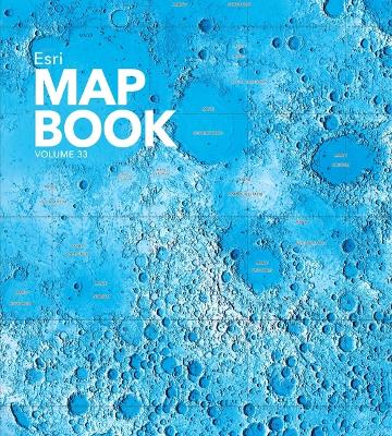
Topographic Map of the Moon
Image Map of the Moon
Hydrocarbon Prospecting in Southern Caribbean
NATURAL RESOURCES-WATER
Changing Patterns of Water Occurrence from 1986 to 2016 in the Tahoua Region of Niger: Implications for Water Resource
PLANNING AND ENGINEERING
Management for Smallholder Farmers and Pastoralist Communities
Visualizing Property Value Cross Sections
Badlands Golf Course
San Francisco Height/Bulk Districts
Filling the Gaps in the Mile High City: Analyzing Infill development suitability in Denver Colorado
Georgia Army National Guard Site Selection Analysis for the US Property and Fiscal Office (USP&FO) and Combined Support Maintenance Shop (CSMS) Developments
A Study of Plot Ratio/Building Height Restrictions in High Density Cities Using 3D Spatial Analysis Technology
Connecting the DC Region
Climate-Smart Cities Boston
Smart GeoPlanner
3D National Map of Singapore
City Visualization Sweden
Electronic Map for Land-Use Planning inTyrol
TELECOMMUNICATIONS
Tracking the Share of IOT
Cellular Coverage Modeling in the United Kingdom
TOURISM AND RECREATION
California, Nevada tourist map
Wasatch Front Recreation
Baranof Island, Sitka Ranger District, Tongass National Forest
TRANSPORTATION
Transit Authority of Northern Kentucky
Merrill Field Airport Master Plan Update and Noise Exposure Plan
The Northwest Seaport Alliance North & South Harbor Maps
Impact of the Metrorail
3D Application of the Big Data Study
UTILITIES-ELECTRIC AND GAS
North American Natural Gas System
Planned Generation in N. America
UTILITIES-WATER AND WASTEWATER
Sewer Facilities - Cover Sheet
West Basin Municipal Water District's CY 2016 Recycled Water Usage Volumes
Mapping the Distribution of Water Use in Illinois
Public Water Supply
Is Climate Change Affecting Your Water System?