Atnaujinkite slapukų nuostatas

El. knyga: Hillforts and the Durotriges: A geophysical survey of Iron Age Dorset

Illustrated by , , Contributions by , Commentaries by ,
  • Formatas: 186 pages
  • Išleidimo metai: 20-Nov-2017
  • Leidėjas: Archaeopress Archaeology
  • Kalba: eng
  • ISBN-13: 9781784917166
Kitos knygos pagal šią temą:
  • Formatas: 186 pages
  • Išleidimo metai: 20-Nov-2017
  • Leidėjas: Archaeopress Archaeology
  • Kalba: eng
  • ISBN-13: 9781784917166
Kitos knygos pagal šią temą:

DRM apribojimai

  • Kopijuoti:

    neleidžiama

  • Spausdinti:

    neleidžiama

  • El. knygos naudojimas:

    Skaitmeninių teisių valdymas (DRM)
    Leidykla pateikė šią knygą šifruota forma, o tai reiškia, kad norint ją atrakinti ir perskaityti reikia įdiegti nemokamą programinę įrangą. Norint skaityti šią el. knygą, turite susikurti Adobe ID . Daugiau informacijos  čia. El. knygą galima atsisiųsti į 6 įrenginius (vienas vartotojas su tuo pačiu Adobe ID).

    Reikalinga programinė įranga
    Norint skaityti šią el. knygą mobiliajame įrenginyje (telefone ar planšetiniame kompiuteryje), turite įdiegti šią nemokamą programėlę: PocketBook Reader (iOS / Android)

    Norint skaityti šią el. knygą asmeniniame arba „Mac“ kompiuteryje, Jums reikalinga  Adobe Digital Editions “ (tai nemokama programa, specialiai sukurta el. knygoms. Tai nėra tas pats, kas „Adobe Reader“, kurią tikriausiai jau turite savo kompiuteryje.)

    Negalite skaityti šios el. knygos naudodami „Amazon Kindle“.

This volume sets out the results of a detailed programme of non-intrusive geophysical survey conducted across hillforts of Dorset (UK), generating detailed subsurface maps of archaeological features, in the hope of better resolving the phasing, form and internal structure of these iconic sites.

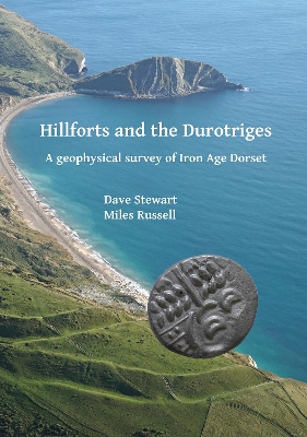
Hillforts are among the most dramatic and visually striking of prehistoric monuments in the British Isles. Dorset, in southern England, is particularly rich in these Iron Age earthwork enclosures, with over 30 examples being so far recorded, including the internationally famous sites of Maiden Castle, Hod Hill, Badbury Rings and Hambledon Hill. Many have been the subject of archaeological investigation, such as the excavations conducted at Maiden Castle in the 1930s by Tessa and Mortimer Wheeler, but few have, to date, been intensively examined. This volume sets out the results of a detailed programme of non-intrusive geophysical survey conducted across the Dorset hillforts, generating detailed subsurface maps of archaeological features, in the hope of better resolving the phasing, form and internal structure of these iconic sites. The dataset presented here not only helps to change our perception of what hillforts were, how they functioned and what went on within them, but also provides a way of assessing their longevity, reconsidering how they were perceived and reused in subsequent periods. Given the oft-cited association between the Dorset enclosures and the Durotriges tribe, who are thought to have occupied the area in the Later Iron Age, serious consideration is also for the first time given to the belief that hillforts formed the focus of conflict between the native tribes and the armies of imperial Rome in the first century AD.
List of Figures
iii
1 Introduction: The Durotriges Project
1(6)
Miles Russell
Paul Cheetham
2 Defining Hillforts in Dorset
7(6)
Dave Stewart
Miles Russell
3 A History of Dorset Hillfort Investigation
13(12)
John Gale
4 The Survey
25(120)
Dave Stewart
4.01 Abbotsbury
26(5)
The Site
26(3)
Results
29(1)
Interpretation
30(1)
4.02 Badbury Rings
31(6)
The Site
31(3)
Results
34(1)
Interpretation
34(3)
4.03 Banbury
37(3)
The Site
37(1)
Results
37(1)
Interpretation
37(3)
4.04 Bulbury
40(3)
The Site
40(1)
Results
40(1)
Interpretation
41(2)
4.05 Buzbury
43(5)
The Site
43(2)
Results
45(1)
Interpretation
45(3)
4.06 Chalbury
48(6)
The Site
48(1)
Results
48(1)
Interpretation
49(5)
4.07 Chilcombe
54(5)
The Site
54(5)
Interpretation
59(1)
4.08 Coney's Castle
59(7)
The Site
59(5)
Results
64(1)
Interpretation
65(1)
4.09 Dungeon Hill
66(6)
The Site
66(3)
Results
69(2)
Interpretation
71(1)
4.10 Eggardon
72(5)
The Site
72(1)
Results
73(3)
Interpretation
76(1)
4.11 Flowers Barrow
77(4)
The Site
77(3)
Results
80(1)
Interpretation
80(1)
4.12 Hambledon Hill
81(9)
The Site
81(1)
Results
82(8)
Interpretation
90(1)
4.13 Hod Hill
90(11)
The Site
90(7)
Results
97(2)
Interpretation
99(2)
4.14 Lambert's Castle
101(5)
The Site
101(1)
Results
102(2)
Interpretation
104(2)
4.15 Maiden Castle
106(7)
The Site
106(3)
Results
109(3)
Interpretation
112(1)
4.16 Nettlecombe Tout
113(4)
The Site
113(1)
Results
113(3)
Interpretation
116(1)
4.17 North Poorton
117(4)
The Site
117(1)
Results
117(1)
Interpretation
117(4)
4.18 Pilsdon Pen
121(6)
The Site
121(1)
Results
121(1)
Interpretation
122(5)
4.19 Poundbury
127(6)
The Site
127(1)
Results
128(4)
Interpretation
132(1)
4.20 Rawlsbury
133(4)
The Site
133(2)
Results
135(1)
Interpretation
136(1)
4.21 Spettisbury
137(8)
The Site
137(4)
Results
141(1)
Interpretation
142(3)
Location, location, location
145(1)
5 Understanding Hillforts: What Geophysical Survey is Teaching Us
145(10)
Dave Stewart
Habitation
146(3)
Subsequent Use
149(4)
Afterword
153(2)
6 Once Upon a Hill: Uncoupling the Durotriges
155(14)
Miles Russell
Maiden Castle
158(4)
Spettisbury
162(4)
Hod Hill
166(3)
Conclusions 169(2)
References 171(4)
Acknowledgements 175