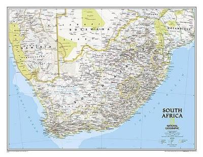
National Geographic's wall map of South Africa features the country's nine provinces along with the bordering countries of Namibia, Botswana, Zimbabwe, Mozambique, Swaziland, and Lesotho. Also included are southern Africa's premier wildlife venues -- its national parks and reserves.
Many local language place-names are used reflecting the region's rich cultural diversity. Physical geography details include shaded relief and cartographic patterns used to depict sand, salt pans, and swamps. This map also features a detailed transportation network including highways, roads, passenger railroads, and major airports. All proceeds from the purchase of a National Geographic map help support the Society's vital exploration, conservation, scientific research, and education programs.
- Map Scale = 1:3,044,000
- Sheet Size = 30.25" x 23.5"