Atnaujinkite slapukų nuostatas

Streetcars and the Shifting Geographies of Toronto: A Visual Analysis of Change [Minkštas viršelis]

5.00/5 (12 ratings by Goodreads)
  • Formatas: Paperback / softback, 277 pages, aukštis x plotis x storis: 279x216x20 mm, weight: 1050 g, 260 colour illustrations, 3 b&w illustrations, 3 b&w figures,10 b&w tables, 4 b&w maps
  • Išleidimo metai: 22-Feb-2022
  • Leidėjas: University of Toronto Press
  • ISBN-10: 1487500106
  • ISBN-13: 9781487500108

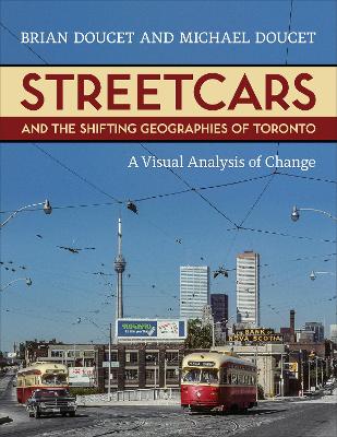
Streetcars and the Shifting Geographies of Toronto visually compares historic and contemporary images of different parts of Toronto to better understand how and why the city has changed.


When looking at old pictures of the city of Toronto, it is clear that the city’s urban, economic, and social geography has changed dramatically over the generations. Historic photos of Toronto’s streetcar network offer a unique opportunity to examine how Toronto has been transformed from a provincial, industrial city into one of North America’s largest and most diverse regions.

Streetcars and the Shifting Geographies of Toronto studies Toronto’s urban evolution through an analysis of photographs taken by streetcar enthusiasts, beginning in the 1960s. These photographers did not intend to record the urban form, function, or social geographies of the city; they were "accidental archivists" whose main goal was to photograph the streetcars themselves. But today, their images render visible the ordinary, day-to-day life in the city in a way that no one else did. These historic photographs show a Toronto before gentrification, globalization, and deindustrialization. Each image has been re-photographed to provide fresh insights into a city that is in a constant state of flux.

Gorgeously illustrated, this unique book offers an understanding of how Toronto has changed, and the reasons behind these urban shifts. The visual exploration of historic and contemporary images from different parts of the city helps to explain how the major forces shaping the city affect its city form, functions, neighbourhoods, and public spaces.

List of Figures and Tables
ix
Acknowledgments and Preface xiii
Introduction: Streetcar Photography and the Changing City 1(6)
Chapter 1 The Changing Geography of Toronto
7(28)
Chapter 2 Toronto in a Global Context
35(16)
Chapter 3 Neighbourhood Change
51(34)
Chapter 4 Visual Methodologies and Repeat Photography
85(12)
Chapter 5 Photographing Streetcars; Picturing Toronto
97(26)
Chapter 6 A Short History of Toronto's Streetcars
123(108)
Photo Portfolios
135(2)
Portfolio 1 Downtown
137(28)
Portfolio 2 (De)industrialization
165(24)
Portfolio 3 Neighbourhoods
189(42)
Chapter 7 Interpreting Visual Change in a Divided City
231(16)
Chapter 8 Neighbourhood Change, Mobility, and Socially Just Solutions
247(18)
Notes 265(24)
Index 289
Brian Doucet is the Canada Research Chair in Urban Change and Social Inclusion in the School of Planning at the University of Waterloo.

Michael Doucet is an emeritus professor of geography at what was long known as Ryerson University.