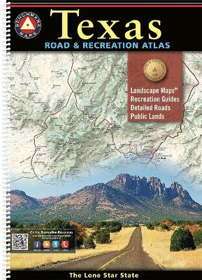
Everything is bigger in Texas, and our atlas is no exception! The Texas Road & Recreation Atlas is our largest title, featuring 200 pages of maps and guides covering the vastness of the Lone Star State from its most-populous cities to its remote desert mountains. The field-checked Landscape Maps reveal back roads & landforms with amazing realism and detail, illustrating how the state's network of roads and local recreation landmarks fit into its topography. The 20-page Recreation Guide provides regional maps alongside categorized recreation listings and detailed information resources to help you map out your trip. This atlas is the ideal tool for planning and navigating your next Texas adventure, whether it's a simple day trip or an extended exploration of the Lone Star State.
Landscape Maps
Detailed and updated shaded relief illustrating current land use & vegetation land cover Exceptional and updated highway & back road detail Historical markers Public land boundaries and access points Page to page map overlap Recreation Guide
Regional maps with public land detail, recreation points of interest, point-to-point mileages, public hunting areas, and more
Categorized listings include National & State Parks, Trails & Natural Wonders, Campgrounds, Fishing & Boating, Museums & Historic Sites, and more 200 Pages. 3rd Edition, 2025. Spiral-bound. ISBN 9798986387956
Map Scales:
Landscape Maps 1:253,400 (1'=4 miles) Recreation Maps 1:1,267,200 (1'=20 miles)