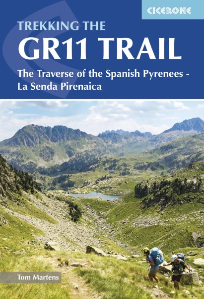
A guidebook to hiking the 850km (520 mile) GR11 (La Senda Pirenaica) trail between Irun on the Atlantic coast and Cap de Creus on the Mediterranean. Over the years it has become a well-defined hiking trail which mostly goes over good hiking paths through largely unspoilt and wild mountains and is suitable for experienced mountain hikers.
The GR11 is one of the long-distance trails which crosses the whole Pyrenees, staying on the Spanish side of the border. It is presented here in 47 stages of 7-31km (5-19 miles), four sections are given to allow the route to be broken into shorter treks.
- Step-by-step route description and 1:100,000 mapping provided for each stage
- Highlights include Navarre, Ordesa, Monte Perdido, Valles Occidentales, Posets-Maladeta, Parc Natural Alt Pirineu
- Route Summary Table and Stage Facilities Planner to help plan itineraries
- Detailed information on planning, local flora and fauna and accommodation
- GPX files available to download
The GR11 trail traverses the Spanish Pyrenees from Irun on the Atlantic coast to Cap de Creus on the Mediterranean. Leading over high passes and through sweeping valleys, the 850km route is presented in 47 stages. Trekkers require experience of high mountains.
Tom Martens grew up in Belgium and first visited the Pyrenees in 2008 with a friend who had made him enthusiastic about the mountain chain. This first exploration was so enchanting that he has been back every year since. He has hiked extensively in the national parks and has traversed the whole length of the Pyrenees several times. He has guided groups of youngsters on long, intensive hikes and climbed many of the peaks. So far, he has spent 300 nights in the Pyrenees, mostly bivouacking. He has a special interest in mountain wildlife. Other regions where you can often find him hiking include Scotland and Estonia, where he currently lives.

 Daugiau apie elektronines knygas